
Lee Vining & Rush Creek Piezometer Monitoring
Mono Lake Committee
 The
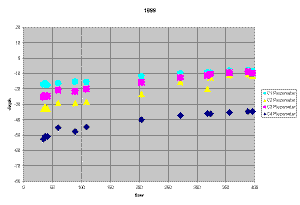
Mono Lake Committee has been monitoring piezometers (plastic “wells” in
which the depth to groundwater can be measured) in the Rush and Lee Vining
Creek bottomlands since 1995. There are six piezometers on Rush Creek
between the main channel and Channel 10, first read in September 1995 just
before Channel 10 was rewatered. There are ten piezometers on Lee Vining
Creek between the main channel and the A-4 Channel, first read in June
1995. The piezometer monitoring
protocol is here.
The
Mono Lake Committee has been monitoring piezometers (plastic “wells” in
which the depth to groundwater can be measured) in the Rush and Lee Vining
Creek bottomlands since 1995. There are six piezometers on Rush Creek
between the main channel and Channel 10, first read in September 1995 just
before Channel 10 was rewatered. There are ten piezometers on Lee Vining
Creek between the main channel and the A-4 Channel, first read in June
1995. The piezometer monitoring
protocol is here.
In 1997, McBain & Trush requested stage readings in the channels near the piezometers so that groundwater height could be correlated to the height of water in the stream channel. Four green metal stakes were hammered into the channels during a flow of 230 cfs, and thus some did not end up vertical. The distance along the stake from the top to the water level has been measured since then.
In 1999, McBain & Trush installed two staff plates to read the stage of the stream. One is in the B-1 connector and the other is in the B-1 Channel (A-4 plus B-1 connector). These are read periodically when the piezometers and green stakes are monitored.
This dataset has shown some interesting trends over the years in response to flood events and dry years. The January 1997 flood on Lee Vining Creek caused a redistribution of flow between the main and A-4 channels, causing more flow to enter the A-4 Channel and the groundwater to rise significantly. High water marks from the flood were obtained on some piezometers, which provided data for the peak flow.
In 2001 and 2002, by the end of the year, all the piezometers along Lee Vining Creek went dry for the first time. This did not occur in 2003. Water levels typically closely reflect streamflow, however there is multi-year decline after the last wet year, and a decline based on that year's peak flow and runoff. Understanding of multi-year trends and the importance of high flows would allow better management of bottomlands groundwater conditions and describe how restoration of Mill Creek bottomlands could occur.
-
Lee Vining Creek Piezometer Data and Graphs (Excel File)
-
Rush Creek Piezometer Data and Graphs (Excel File)
Note: Please use this
data with caution. Flows are approximate and preliminary. Heights of
piezometers above ground change. Original data sheets can be viewed in
person upon request: ![]() .
.