
Early Photos of Rush Creek
| PART 1: ELDEN VESTAL PHOTOS FROM THE 1940s (download 69 MB zipfile) |
Many of these photos show historical conditions that existed soon after Los Angeles Department of Water and Power (DWP) began diversions. Voluminous irrigation diversions also occurred below DWP's diversions. The flow visible, in many cases, is springflow.
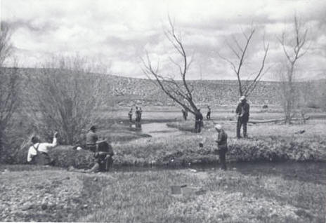
People fishing on Lower Rush Creek on May 2,
1948. At least 11 anglers are visible in this photograph.
May 2, 1948 flow below Grant Lake Reservoir: 0 cfs.
Rush Creek as it entered Mono Lake. Paoha Island is in the background to
the left. Rush Creek split into many channels along the delta, creating
small islets--many of which can be seen here.
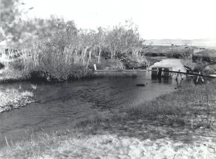
A weir and fish trap on Rush Creek before entering the delta on April
10, 1947. Mono Lake is in the background behind the building. This
building was used by duck hunters.
April 1947 average flow below Grant Lake Reservoir:
49 cfs
April 1947 average flow at highway: 12 cfs
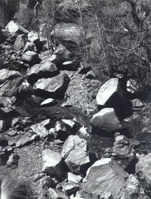
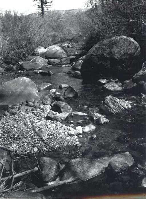
Looking upstream at "The Narrows." Note the soft erosion patterns on the
large boulders. This was caused by centuries of peak water flows. Photo
taken on April 10, 1947.
April 1947 average flow below Grant Lake Reservoir:
49 cfs
April 1947 average flow at highway: 12 cfs
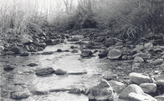
Looking downstream from "The Narrows" on April 10, 1947. Lush vegetation
and deep water pockets created ideal trout habitat.
April 1947 average flow below Grant Lake Reservoir:
49 cfs
April 1947 average flow at highway: 12 cfs
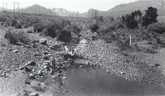
Rush Creek above old highway 395, on July 19, 1939. This was before
Department of Water and Power diversions. Note the heavy logging,
grazing and water diversion damage from local use.
July 1939 average flow above Grant Lake Reservoir: 32
cfs
July 1939 average flow at highway: 2 cfs
| PART 2, PRE-DWP DIVERSIONS (download 74 MB zipfile) |
Historical Photograph Exhibits taken in March 1934 (near the end of the dustbowl drought) from City of Los Angeles vs. Nina B. Aitken. Due to drought and excessive irrigation diversions, there was almost no flow in Rush Creek at the highway that year.
Average Rush Creek runoff is 59,000 acre-feet (81
cfs). Annual flow of water at highway for water year:
1928 - 17,162 acre-feet (24 cfs)
1929 - 8,807 acre-feet (12 cfs)
1930 - 2,274 acre-feet (3 cfs)
1931 - 4,550 acre-feet (6 cfs)
1932 - 13,734 acre-feet (19 cfs)
1933 - 8,521 acre-feet (12 cfs)
John Hart, in the book Storm Over Mono states:
"As they lavished water on the leaky fields of Pumice Valley, the local irrigators were not so much raising a crop as making a point about their water rights. They were boosting the value of a commodity they knew they would soon be forced to sell."
Despite the lack of water, note the ability of the bottomlands (in the last four photos) to stay wet and lush. This is due to both irrigation return water (as springflow) and the nature of the bottomlands: deep narrow multiple channels, low gradient floodplain, dense riparian vegetation, water-holding soil, large woody debris, and natural springflow.
Walker Creek entering Rush Creek above "The Narrows" on the Clover
Ranch property.
An upstream view of Rush Creek from the Walker Creek confluence on
the Clover Ranch property. Note heavy riparian corridor.
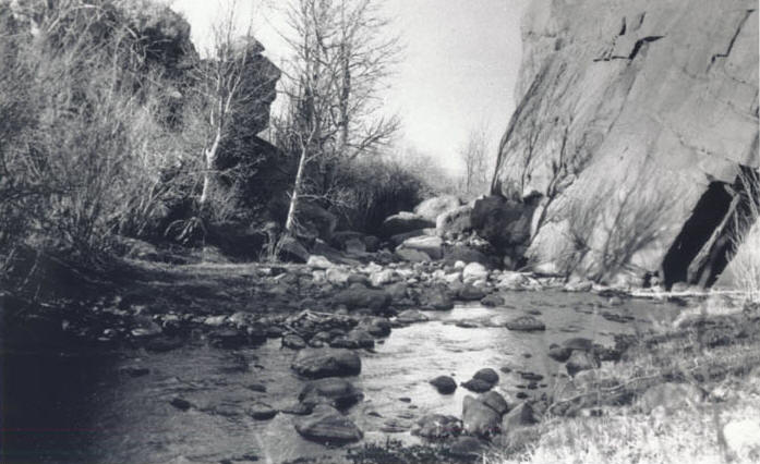
Downstream view of Rush Creek at "The Narrows." This type of pocket
water made for great angling.
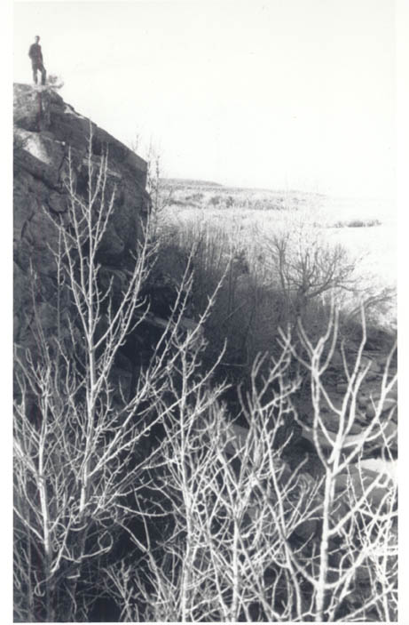
Unidentified person on the west wall of "The Narrows." In the spring
and summer, the thick foliage cover provided excellent fish habitat.
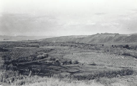
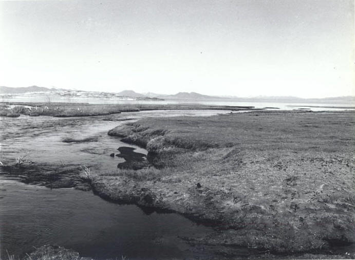
Looking down the bottomlands towards Mono Lake. Vestal Springs is in the
foreground—note the lush meadows and meandering waterways. The Rush
Creek riparian corridor is in the background below the bluffs.
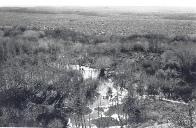
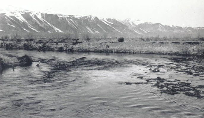
Rush Creek between Mono Lake and "The Narrows" is
known as "The Bottomlands." This photograph looks east near "The Ford," showing
impressive riparian habitat, large stream meanders, ponds and huge mats
of floating watercress.
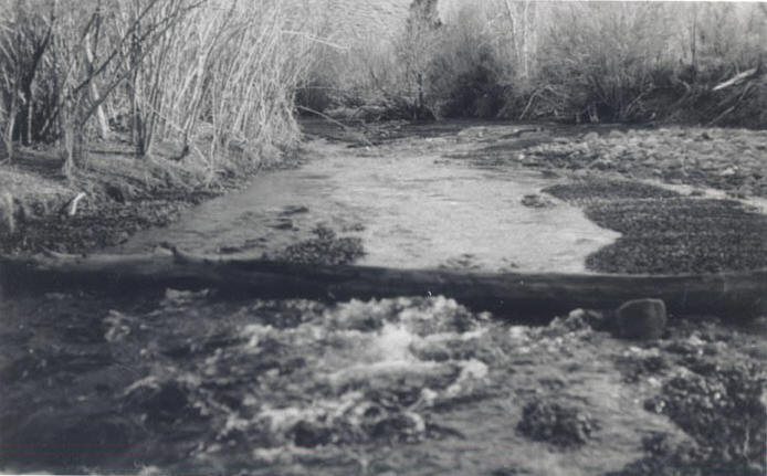
Rush Creek near the "The Ford," where a dirt road crosses the stream.
The dark patches behind the fallen log along both sides of the shore are
mats of watercress.
Northwest view of Rush Creek as it entered the delta area near the
shores of Mono Lake. This is prior to the incision that has created a
deep canyon here.